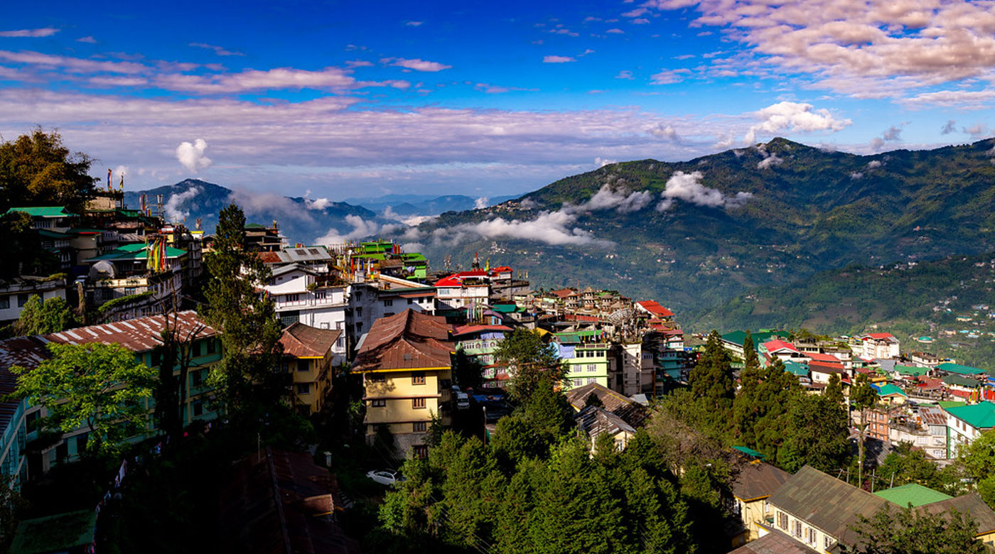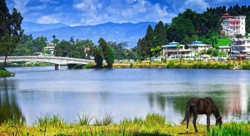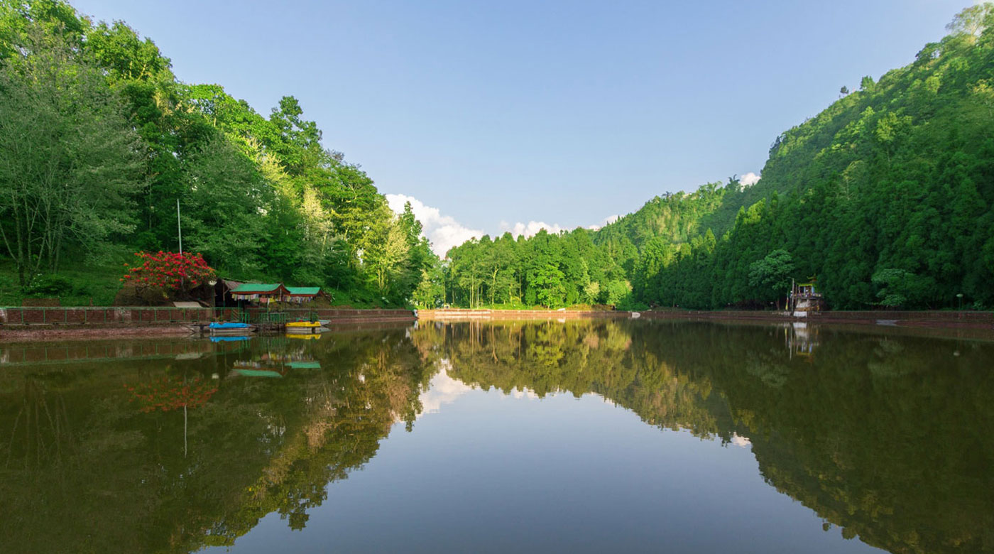
Aritar – Mulkharka Aritar and Mulkharka, two places on the...
ViewSilk Route
The Silk Road derives its name from the lucrative trade in silk carried out along its length, beginning in the Han dynasty in China (207 BCE–220 CE). The Han dynasty expanded the Central Asian section of the trade routes around 114 BCE through the missions and explorations as well as several military conquests. The Chinese took great interest in the security of their trade products, and extended the Great Wall of China to ensure the protection of this trade route.
The Silk Road trade played a significant role in the development of the civilizations of China, Korea, Japan, the Indian subcontinent, Iran, Europe, the Horn of Africa and Arabia, opening long-distance political and economic relations between the civilizations. Though silk was the major trade item exported from China, many other goods and ideas were exchanged, including religions (especially Buddhism), philosophies, sciences, and technologies like paper and gunpowder. So in addition to economic trade, the Silk Road was a route for cultural trade among the civilizations along its network.
In June 2014, UNESCO designated the Chang’an-Tianshan corridor of the Silk Road as a World Heritage Site. The Indian portion, from Jelep-La (near Nathula Pass) to the Great Plain of Bengal, is on the tentative site list.
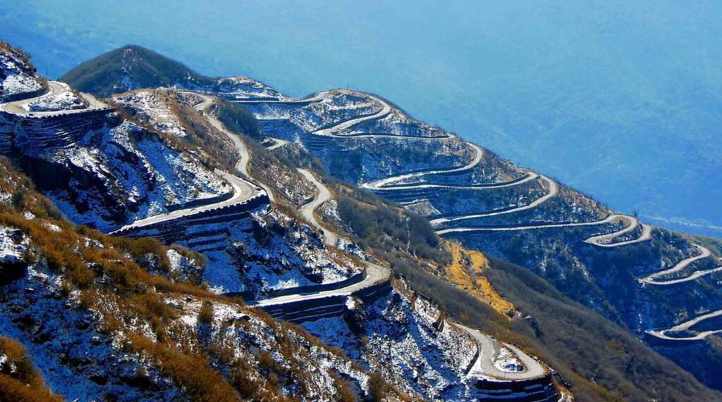
Silk Road, Winter
Covered in snow in winter, Silk Road offers a majestic view from the top
Ever heard of Lhasa? Probably yes. It was and still is the administrative and cultural headquarters of the entire Tibet, China. One of the highest cities of the world by elevation, it was also a major trading hotspot of the ancient times. Do you know what sea-port it was closest to? Probably not, right? The answer is ‘Tamralipta’. Or present day ‘Tamluk’ in West Bengal, India, where now the ‘Haldia’ Port stands as one of the most important shipping ports in eastern India.
The distance between Lhasa and Tamluk was a mere 900 KMs. From Chumbi Valley in Tibet, a thin sliced insert of land between India and Bhutan, recently shot to fame for the Doklam stand-off between India and China, across the Nathu La and subsequently through, the majestic hills of East Sikkim and places such as Aritar, before reaching the plains of Bengal. Another route existed proximal to this one through the Jepep La. Sadly, in modern times, this route is no longer important, no longer relevant in its entirety due to “Borders” put in place by “Progressive” humans of the modern period.
This trade circuit was an offshoot which merged into the historical ancient silk route that connected modern day China to as far as Europe. Chinese Silk was a commodity of luxury and hence was traded extensively, which explains the nomenclature. However, a lot of other intangible things traversed willingly or unwillingly too, with the caravan of horses. Things like knowledge, ideas, religion, cultural exchange, etc.
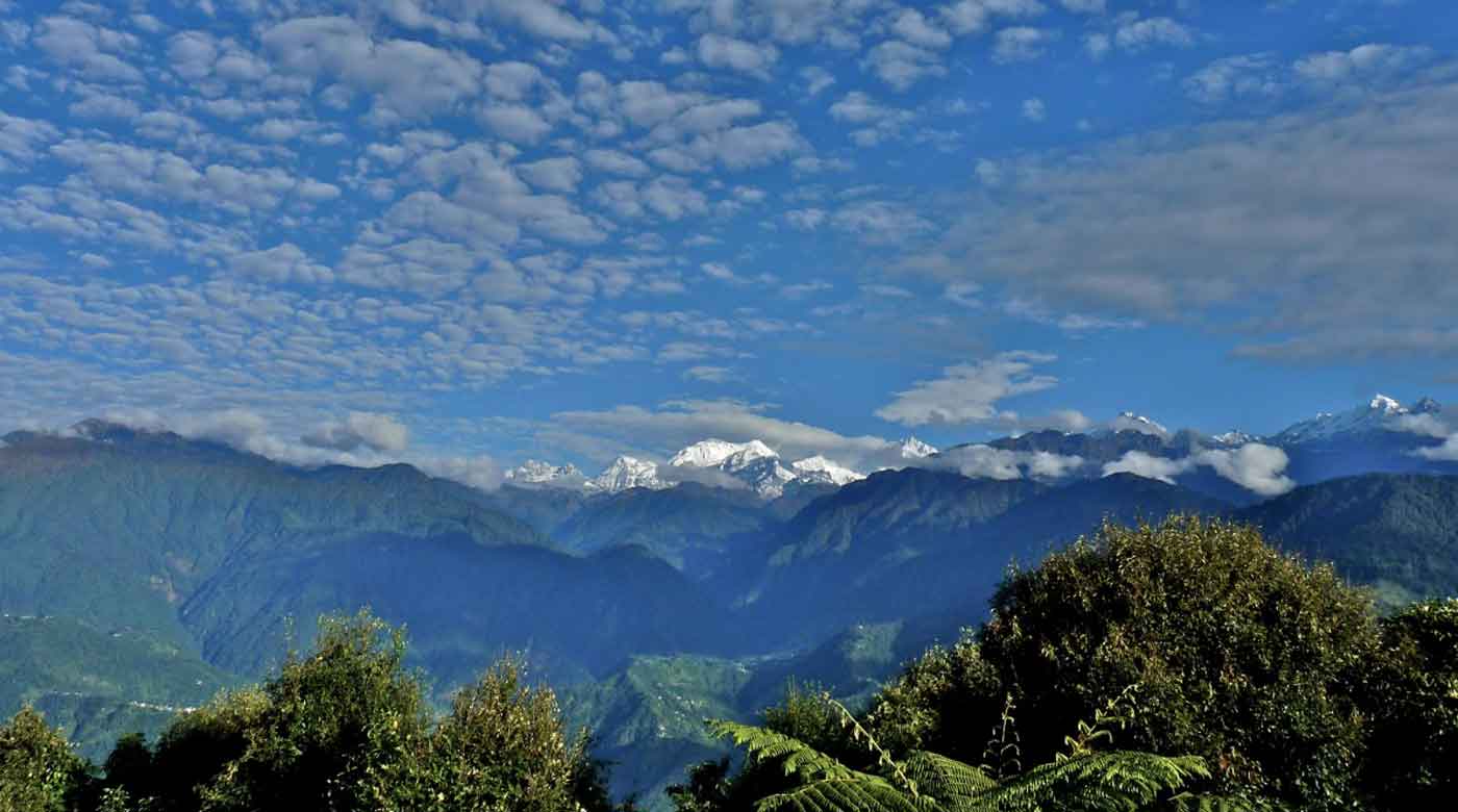
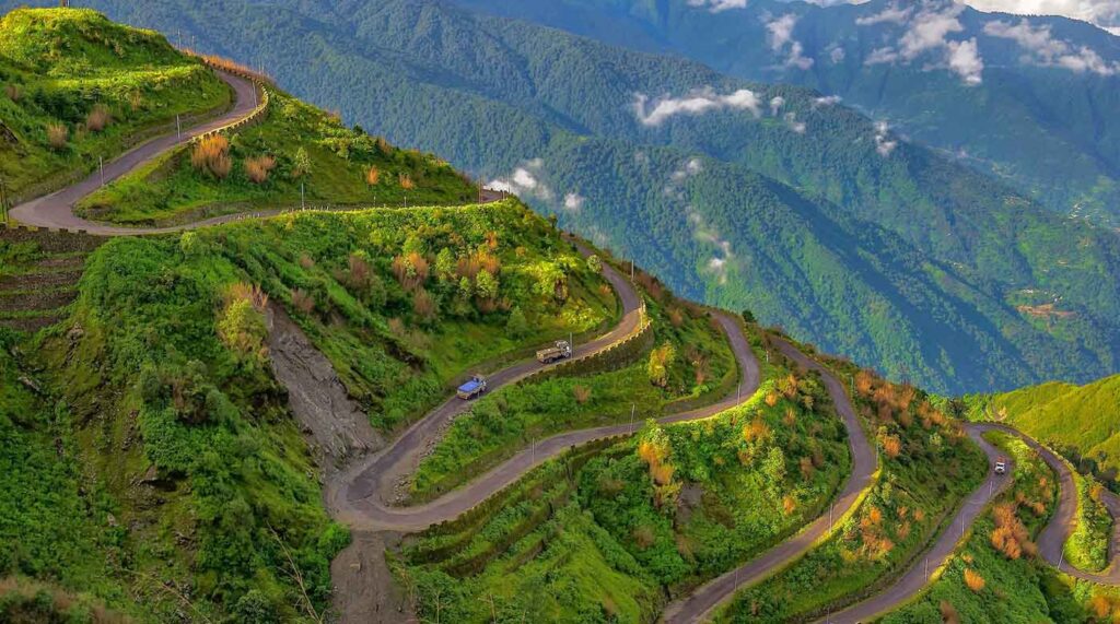
Silk Road, Spring
Spring brings its charm with plantation and greenery of higher altitude along this road
The Indian portion of the route is open for travelers to come and witness. To come and witness the importance of the road, its scenic beauty and historic relevance to the Indian sub-continent.
From ‘Aritar’ on the borders of Sikkim and West Bengal, up till ‘Nathu La’, the region is spectacular and remarkably thrilling, besides all the history that it was once a part of. This region is slowly getting the place it deserves on the otherwise flamboyant tourism scene of Sikkim. However, it is thankfully still an ‘off-beat’ destination owing to the absence of any major towns en-route. The road condition is top notch, being maintained by the BRO as a strategically important way for the army vehicles keeping the supply line green to the forward bases at the international border with China. The trail elevates from about 5,000 ft at Aritarnto 14,500 ft at Nathula Pass over a span of 70 km, passing through lush greenery at its beginning, to glacial lakes and icy mountain passes higher up. Ambling by mountain streams, military camps, small mountain villages, waterfalls and viewpoints, the landscapes this route offers are ecstatic to say the least.
This route connects with Tsongmo Lake and Nathula Pass road coming from Gangtok at near Nathula Pass. There are not many settlements en-route and for the ones that are there, only basic homestay accommodations are available apart from the places at the foothills in Aritar, Rongli, Rhenock and Mulkarkha, which have a couple of luxurious resorts.
How to reach Silk Route?
By Air
The nearest airport is Bagdogra Airport (IXB), located approximately 118 km from Aritar, the base point of Silk Route. Bagdogra airport is connected to all the major cities of India like Delhi, Mumbai, Bangalore, Kolkata, Chennai, etc with daily non-stop flights. From Bagdogra, or Siliguri, you can hire a private vehicle that will get you to Aritar.
By Train
The nearest railway station to Aritar is New Jalpaiguri (NJP), about 112 kilometres away. The station, which is 20 mins drive from Siliguri, is the gateway for all Sikkim, Darjeeling and Bhutan. It is well-connected to major cities like Kolkata, Chennai, Bangalore, Mumbai and New Delhi.
From New Jalpaiguri, you can reserve a taxi to Aritar or go to Siliguri and catch a shared vehicle.
By Road
Aritar is well connected by road to Siliguri. One can either reserve a vehicle or get a shared taxi from many points in Siliguri such as Juction, Pani Tanki or 2nd Mile to Rangpo, and then another vehicle to Aritar.
Things you need to Know About Silk Route
Elevation
5,800 to 13,000 feet above mean sea level
Temperature Range
-13 °C in January to 22 °C in June
Local Language
Nepali, Hindi, Bhutia and English
Food
Indian, Chinese and Authentic Tibetian cuisines.
Festivals
Dusherra, Diwali, Losar, Holi, and Christmas
Religion
Hinduism, Buddhism and Christianity
Do you know?
Amazing facts about silk route
The Route
The Silk Road was a network of trade routes which connected the East and West Asia, and was central to the economic, cultural, political, and religious interactions between these regions from the 2nd century BCE to the 18th century
Yak Golf Course
Yak golf course is the highest altitude golf course in the world at 13,025 feet above sea level in Kupup, East Sikkim
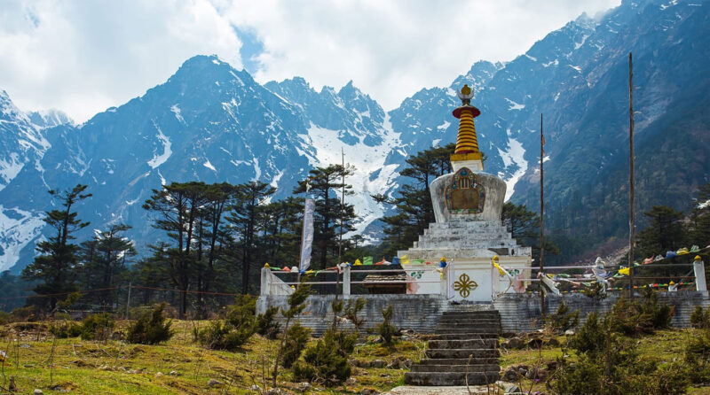
Nathang Valley
The ‘apple of the eye’ of the entire Silk Route, Nathang Valley at 13500 ft. is magnificent and due to its pristine landscapes, sometimes, it is also referred to as ‘Ladakh of the East'
Thambi Viewpoint
Thambi Viewpoint, at 11600 feet, is particularly famous for the sunrise over the Kanchenjunga, besides also offering a majestic view of the loops. The loops look like a serpent laying over a mountain ridge.
Best time to visit Silk Route
Expected tourist footfall
January
February
March
April
May
June
July
August
September
October
November
December
From mid March till June, Silk Route experiences pleasant weather during the summer season. The temperature hovers 2°C to 20°C during the season. It is the best time to visit if you would like to escape the heat.
From July till September, monsoons causes swift rainfall, many a time causing landslides and road blockage. This is not the best time to visit.
From October till March, winter is the best time for travelling to Silk Route. The temperature ranges between -13°C and -2°C during the season. It is the perfect time to visit for the spectacular view of the snow capped mountains. Snow adventures, vibrant festivals and bone chilling cold makes perfect time to visit to Tsongmo. But however, this Silk Route remains inaccessible in December and January.
Cost Calculator
Know approximate COST of your tour instantly
Approximately, {{tour_duration}} night tour to Sikkim and Darjeeling for {{no_of_adults}} adults should cost you around Rs {{calculated_cost}} in total including stay, travel, sight-seeing, breakfast, dinner and pickup -drop from Bagdogra/NJP plus roughly Rs {{math_resultfood}} for lunch depending upon the food you choose to eat.
We, Greenfield Holidays, specialize to offer customized tour packages to major tour destinations clubbed with the offbeat destinations around them to give you the superior experience that no other agency can provide.
Get in touch with us today to customize your tour.
Get in touch with us today to customize your tour.
1
1
https://greenfieldholidays.com/wp-content/plugins/nex-forms-express-wp-form-builder
false
message
https://greenfieldholidays.com/wp-admin/admin-ajax.php
https://greenfieldholidays.com/silk-route
yes
1
Cost Calculator
Know approximate COST of your tour instantly
Approximately, {{tour_duration}} night tour to Sikkim and Darjeeling for {{no_of_adults}} adults should cost you around Rs {{math_resultcost}} in total including stay, travel, sight-seeing, breakfast, dinner and pickup -drop from Bagdogra/NJP plus roughly Rs {{math_resultfood}} for lunch depending upon the food you choose to eat.
We, Greenfield Holidays, specialize to offer customized tour packages to major tour destinations clubbed with the offbeat destinations around them to give you the superior experience that no other agency can provide.
Click on the Whatsapp icon below to get in touch with us today to customize your tour.
Click on the Whatsapp icon below to get in touch with us today to customize your tour.
1
1
https://greenfieldholidays.com/wp-content/plugins/nex-forms-express-wp-form-builder
false
message
https://greenfieldholidays.com/wp-admin/admin-ajax.php
https://greenfieldholidays.com/silk-route
yes
1
Book Tour packages with Silk Route
No posts found!
Other popular Destinations

Mirik Lake
Mirik Lake Mirik is a picturesque tourist spot nestled in...
View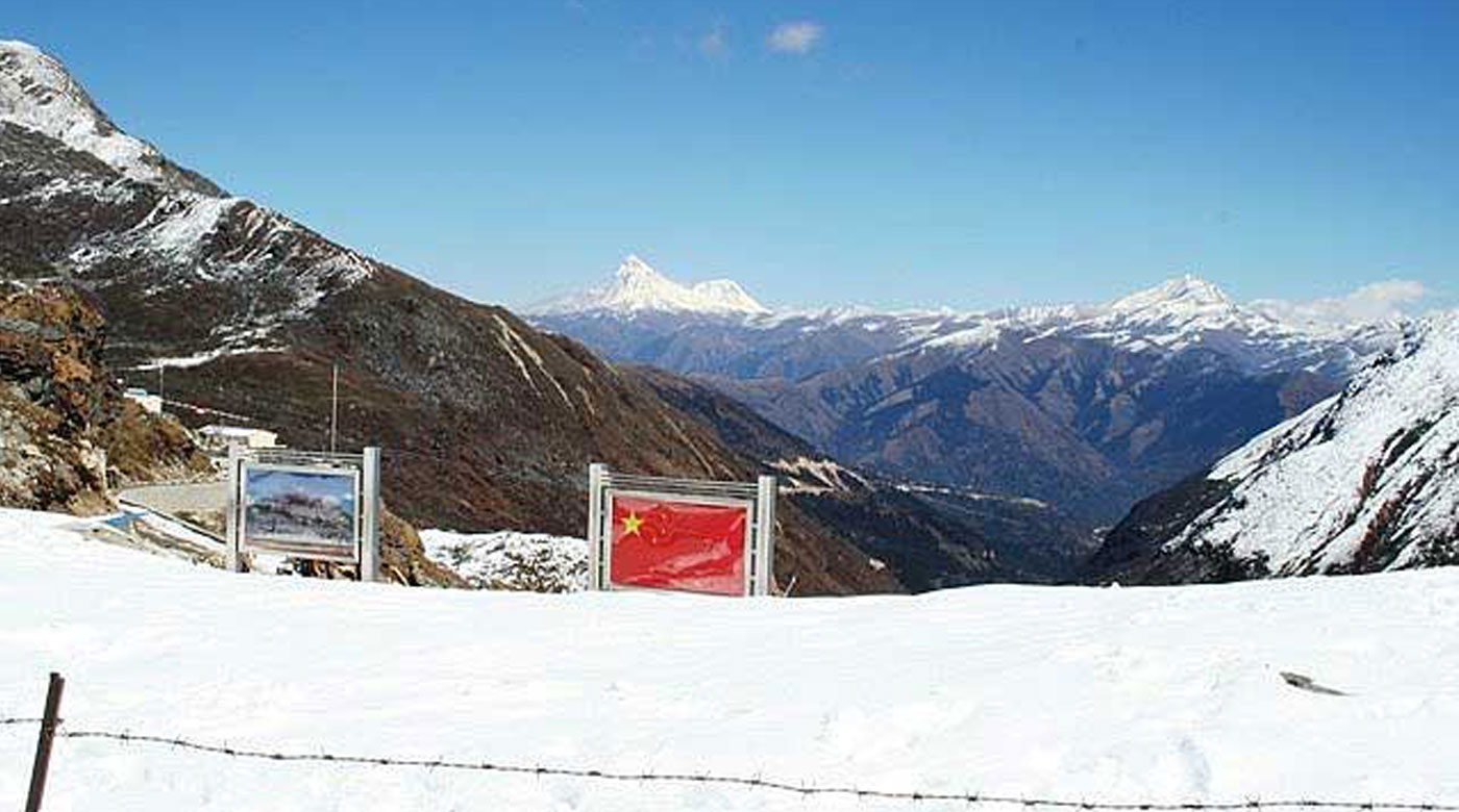
Nathula Pass
Nathula Pass The rugged beauty of this pass attracts a...
View